Indianapolis (Madison State Road)
Indianapolis, IN
Jan 20, 2008
This album is a collection of photos that we took while traveling from Indianapolis to Madison, Indiana on January 20-21, 2008. The route we took was along a road that used to be called the "Madison State Road" which was completed in 1824. Some of the pictures were taken while heading toward Madison on the 20th and some were taken while returning to Indianapolis on the 21st. All of the photos are geocoded and you can get their precise location by clicking through on them to Flickr, which also has organized the photos into a map of photo locations that you can reference for more details about where the photos were taken. The turn-by-turn directions can be found here, and a Google map here.
The town of Madison incorporated in 1809, seven years before Indiana achieved statehood (1816), and this riverside town grew quickly. Its position on the Ohio River made it an ideal entry point into the Indiana Territory. Indianapolis was incorporated in 1820. The Madison State Road opened in 1824, linking Madison, Indiana to Indianapolis, Indiana.
There are two main routes between Madison and Indianapolis. The Madison State Road opened in 1824, and traveled from Madison through Columbus and Franklin to Indianapolis. The Michigan Road was completed in 1834 which started in Madison and passed through Greensburg and Shelbyville on its way to Indianapolis before stretching further north to Lake Michigan at Michigan City, Indiana. The two roads never shared any common routing after they left Madison.
The northern terminus of the Madison State Road has always been at the intersection of Meridian Street and South Street, just 5 blocks south of Monument Circle in downtown Indianapolis. This was originally a five-point intersection but in recent years the Eli Lilly Company bought many of the lots in the area and rerouted some of the streets. Meridian Street no longer continues south at this intersection. Southbound traffic is angled onto Madison Avenue, from which they can turn right back onto Meridian Street one block later.
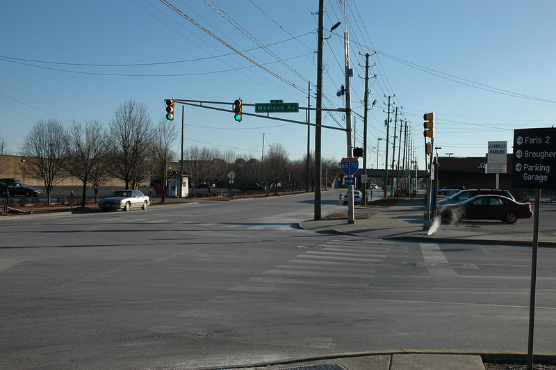
At the northern terminus, facing east at the intersection of Madison Avenue, South Street and Meridian Street, Indianapolis, Indiana. The Madison State Road begins off to the right.

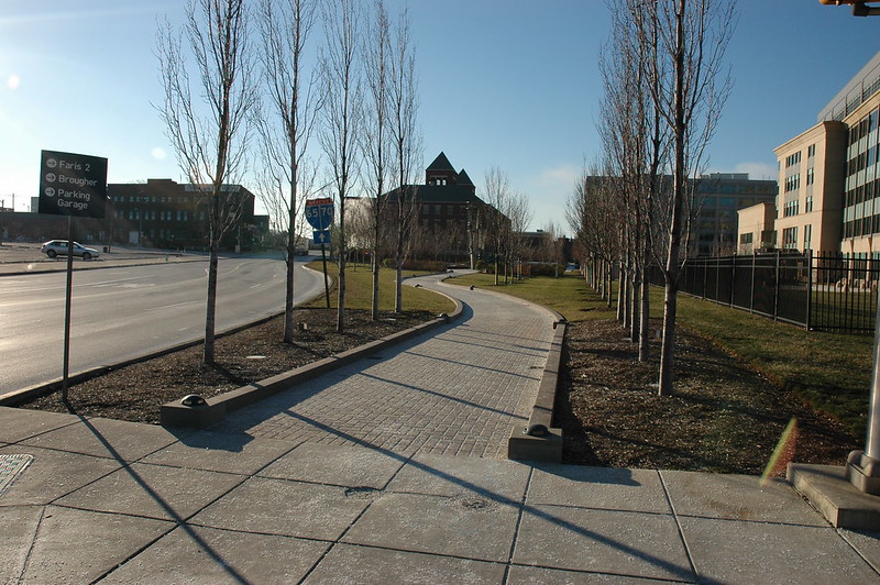
Facing north at the intersection of Madison Avenue, South Street and Meridian Street, Indianapolis, Indiana. On the left (northwest corner) is the Slippery Noodle Inn. This is the view of a traveler arriving in Indianapolis from Madison. The underpass in the photo carries rail lines to Union Station, which is just to the left after passing under the tracks. You can barely make out the Soldiers and Sailors Monument on Monument Circle in the middle of street in the far distance (dedicated 1902). The Monument rises from a circular plaza, 342 feet in diameter, where once stood the governor's house--but where no governor ever lived.
Facing south at the intersection of Madison Avenue, South Street and Meridian Street, Indianapolis, Indiana. Madison Avenue begins its journey angling off to the left (southeast). Originally Meridian Street continued directly south here (where the sidewalk is) until it was reconfigured as part of the Eli Lilly corporate campus.
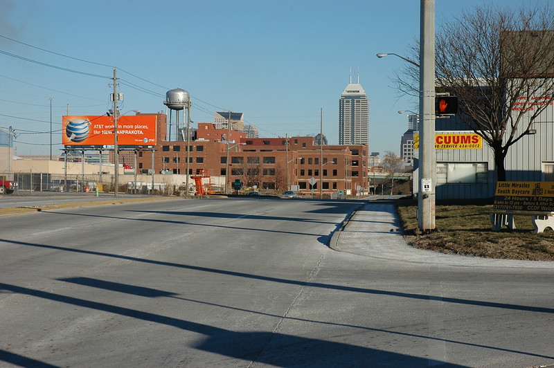
As you continue southeast on Madison, it bends due south again for an interchange with I-70. To get back onto Madison, you will need to turn left onto McCarty Street and then turn right again onto Madison.

Facing south on Madison Avenue at McCarty Street, Indianapolis, Indiana. The railroad bridges are visible, along with a sign for the exit to Morris Street.
The Madison Avenue Expressway was completed around 1958. The expressway was built to speed commuter traffic from the south side of Indianapolis and help with suburban growth. The north end of the expressway created an overpass at Morris Street with some ramps to access it.
Facing north along the Madison Avenue Expressway at Terrace Avenue, Indianapolis, Indiana.
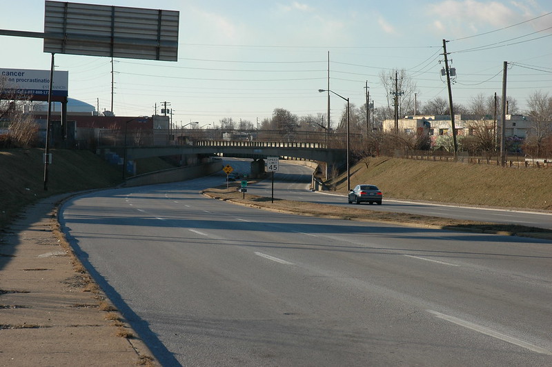
Facing south along the Madison Avenue Expressway at Terrace Avenue, Indianapolis, Indiana. The first underpass is a pedestrian bridge, followed by a railroad underpass.
The road was lowered south of Terrace Avenue and placed just west of the old alignment. If you look up the large hill along the east side of the expressway, you can see Old Madison Avenue towering above.
The expressway continues south under Raymond Street with no ramps to access it. When Madison Avenue reaches Southern Avenue, there is another five-point intersection where Madison again angles off to the southeast. This section was known as the "Miracle Mile" and was a booming area around 1960 but has fallen on harder times, somewhat as a result of its own success.

Facing south at the split between Madison Avenue to the left and East Street to the right, Indianapolis, Indiana. The route markers for US-31 and IN-37 South have been removed in the past several years from the directional sign to Franklin. Instead of the destinations of Homecroft and Southport, the sign on the left used to hold a route marker for IN-431 South when the sign was originally installed.
Madison Avenue, which was the original routing of US-31 on Indy's south side, does not have an interchange with I-465. IN-431 extended south along Madison Avenue from the intersection with East Street, through Edgewood, Southport and Greenwood. Madison Avenue had become IN-431 in 1948 with the building of the US-31 "bypass" which headed due south on East Street. The City of Greenwood had buildings built right up to the sidewalk and there was no way to expand the road there, so the state just bypassed it. The southern terminus was where Madison merges with the current US-31 alignment in Johnson County south of Greenwood.