Devils Tower
Hill City, SD to Pahaska, WY
Jul 12, 2006
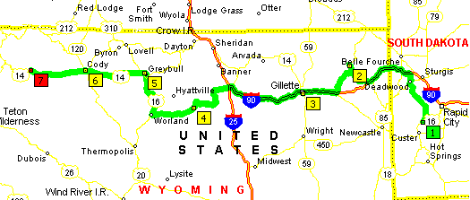
We awoke at the Mount Rushmore/Hill City KOA in South Dakota (sensibly enough, as that is where we had gone to sleep), and took US385 North through Deadwood and up to I-90. We then took I-90 West to Sundance, Wyoming, where we caught US14 to Devils Tower.
Devils Tower National Monument
We got to Devils Tower National Monument and proceeded up to the Visitor Center which was pretty old and very crowded. Tightly packed as it was, we did glean some information about Devil's Tower, such as the fact that its American name is based on some pretty spurious information; actually, all extant records indicate that the native tribes mostly referred to it as something referring to a bear: 'Bear Lodge,' for instance.
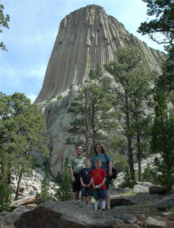
Rowlands at Devils Tower
We walked the Tower Trail which was a loop around the base of the tower that was just under 1.5 miles, although it seemed longer than that. The tower seemed to continually change character as we walked around it, and the human interactions and scenery did the same. On our approach, there were mostly pine trees, not much greenery, and lots of rock. A little desolate looking. We shared the path with several families, and the trees were frequently brightened with a small piece of cloth--a prayer bundle, left by a local native. The area, we were told with signs, is still considered sacred to many local native Americans. As we kept walking, the other families thinned out, and the pines gradually ceded to oaks and other deciduous trees. The far side was much greener and shadier.
Tired from our trek, we took US14 West and back to I-90. We stopped at the Golden Corral in Gillette, Wyoming, for lunch, where we christened Andrew the King of Dessert. From there, we continued on I-90 West to Buffalo, Wyoming, where we exited onto US16 West.
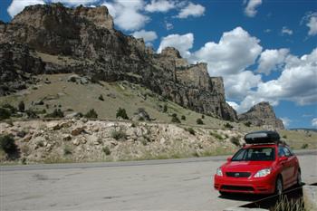
US16 - Tensleep Canyon
After going through Powder River Pass, we drove through Tensleep Canyon. Katherine pronounced it the most beautiful place she had ever seen, and it was beautiful. Every curve brought a new view, each seemingly more interesting than the last.
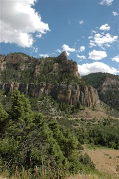
Tensleep Canyon
Tensleep Canyon is part of Bighorn National Forest, and we stopped at many pullouts to take pictures. Many of the rock formations are volcanic in origin, lending a very unique look to them. Katherine also reacquainted herself with the lovely (to her) scent of sagebrush.
We made it to Cody, Wyoming, about time for dinner. The wind had picked up and was pretty fierce on the front edge of a small storm. We saw the cap blowing off of the back of someone's pickup truck, and we just barely missed having a large traffic barricade blow into our car. We stopped at Granny's Restaurant. Chris had a turkey manhattan, Katherine had the dinner salad, Steve had a hamburger, and Andy had a cheese pizza. Andrew enjoyed two cups of hot cocoa, and Katherine remarked that the waiter reminded her a good deal of Susan's dear hubby.
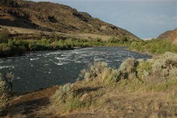
North Fork Shoshone River
We got back on US16/US14/US20 and headed west the 50 additional miles to our lodging for the night. The highway followed the north fork of the Shoshone River and had several scenic vistas, and it certainly seemed deserving of Theodore Roosevelt's proclamation that it was the most scenic fifty miles in the country.
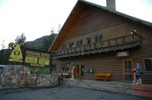
Pahaska Tepee
We arrived at the Pahaska Tepee lodge, just 2 miles from the east entrance to Yellowstone National Park. It is one of two lodges created by Buffalo Bill Cody, and the original lodge building is still standing on the premises.
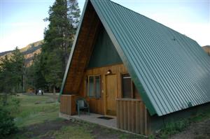
Cabin #8, Pahaska Tepee
We spent the night in one of the riverview cabins, #8.